Translated by Kang Euigoo.
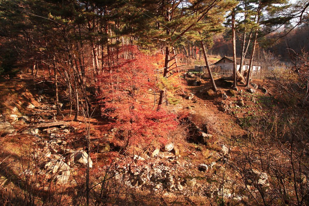
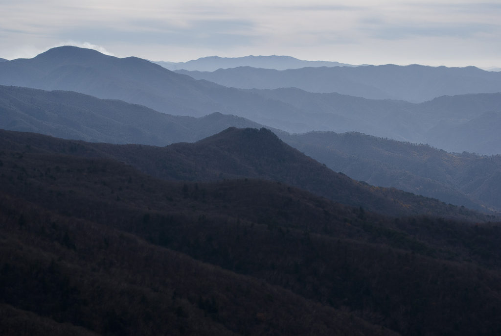
We had been staying in a small town called Huechang 회창 about sixty kilometers east of Pyongyang in Pyeongannam-do. Today we were scheduled to drive a long one hundred kilometers north to a mountain called Baek-san 백산 1449m which sits on the Baekdu Daegan west of the Geumya-gang river in Hamgyeongnam-do, which eventually empties into the 영흥만 in 원산. As usual the mountain names had been plucked off the 신산경표 map by myself, and my hosts were doing the best they could to get me there. Driving through the North Korea countryside early in the morning had become a routine for us, and the scenery had always been enchanting. Unsealed dusty roads trickled alongside fresh clear mountain streams on which small farming villages and communities resided. The mid to late October weather had been brilliantly fine most days, but the dryness of the Autumn sun had sizzled the mountains and countryside into a scratchy color of beaten gold which resembled the mangy hide of a village dog.
We rolled through the small towns, stopping at occasional checkpoints where we would produce our travel documents to soldiers. Each checkpoint we got through got us closer and closer to the mountains. Without highly detailed maps, it often felt like I was wandering in a lost land in another time. It was refreshing and reminded me of how I liked to get lost in the mountains of South Korea, sauntering for weeks from temple to temple and village to village, all measure of time and responsibility forgotten in the bliss of mountain maze.
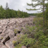
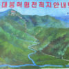
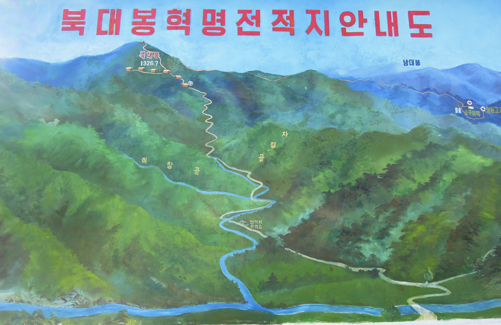
I knew we had travelled north when we crossed the Namgang-jimaek passing through the small town of Sinyang 신양 in 펑안남도, edging our way closer to the Great Ridge, when soon after, and in the middle of nowhere we stumbled upon the entrance to a mountain called Bukdae-bong 북대봉 1326m, that according to the map, just branched off the Baekdu Daegan near the Cheongdumu-jimaek 청두무지맥. A large concrete signboard displayed a vivid color painting of a mountain map with trails leading up it. We stopped to take a look, and decided if it would be a worthy detour.
백두산과 지리산을 굳건히 연결하고 있는 거대한 산의 줄기인 백두대간은 나한테 많은 흥분된 상상을 불러일으킨다. 백두대간은 신비하고 독특한 산 문화로 한반도를 연결하고 있다. 지도에서 한국을 보면 산의 이름들이 점재하고 있는데 그 산 이름들은 바위에 새겨진 글씨처럼 한국인의 시적 정체성을 나타내고 있다. 북한에서의 나의 작업의 일부는 산들이 한국인에게 끼친 다양한 문화적 영향을 찾는 것이다. 백두대간은 이를 위한 나의 주된 과제이다. 남북한이 정치적으로 매우 다르기 때문에, 나의 이런 탐구에서 나는 흔히 남북한이 하나였을 때의 그들의 역사를 고려하게 된다.
우리는 평양에서 동쪽으로 약 60 km 떨어진 평양남도 희창이라는 작은 읍에 머물고 있었다. 오늘은 100 km 북쪽에 있는 백산(1449 km)에 갈 예정이었다. 이 산은 함경남도의 금야강의 서쪽에 뻗고 있는 백두대간에 자리잡고 있다. 늘 그렇듯이 내가 신산경표에서 산을 지적하면 인솔자들이 나를 그곳으로 데려가려고 최선을 다한다. 우리는 흔히 이른 새벽에 북한의 시골을 자동차로 달렸는데, 늘 경치가 매우 아름다웠다. 포장되지 않은 흙 길이 산에서 흐르는 맑고 깨끗한 냇물을 따라 구불구불 나아갔는데, 그런 산기슭에 작은 농촌 마을이 있었다. 10월 중순에서 하순으로 접어들고 있는 시기여서 거의 매일 쾌청한 날씨를 보였다. 가을의 따가운 햇살로 인해 강산이 건조하고 마을의 똥개 털처럼 누런색이 되었다.
우리가 탄 도요타 자동차가 이런 작은 마을들을 지나갔는데, 가끔 검문소에서 멈추었다. 거기서 우리는 군인들에게 증명서를 보여주었다. 검문소를 지날 때마다 우리가 산에 더 접근한 것이었다. 세밀하고 정확한 지도가 없었기 때문에 흔히 나는 다른 때 길을 모르는 땅에서 헤매고 있는 듯이 느껴졌다. 그렇게 방향을 모르고 다니는 것도 나에게는 무척 재미있었다. 내가 남한의 산에서 길을 잃었을 때 얼마나 즐겼는지를 상기했다. 나는 여러 번 몇 주일 동안 남한의 산들 속의 미로에서 시간의 흐름도 모르고 책무도 망각한채 이 절에서 저 절로, 이 마을에서 저 마을로 돌아다니면서 더 없는 행복을 느꼈던 일들이 있다.
우리가 신양이라는 작은 읍을 통과할 때 나는 우리가 이미 남강지맥을 횡단해 백두대간에 더 다가갔다는 것을 알았다. 그런데 거기서 우리는 느닷없이 북대봉(1326m)의 진입구를 만났다. 그 산은 청두무지맥 근처에서 백두대간을 벗어나 있었다. 그 산 입구에 커다란 시멘트 간판이 있었는데, 선명한 색으로 산길들을 보여주고 있었다. 우리는 차를 세워 그 간판을 보고는 예정에 없지만 이 산에 올라가 보는 것이 좋겠다고 결정했다. 그러나 우리는 먼저 갖고 있는 다른 지도들을 조사했다. 나의 한 지도는 아주 자세하지는 않지만 도로가 표시되어있고 한글과 한문으로 표기되어있었다. 그 지도는 내가 서울의 중앙지도사에서 산 것이다. 내가 지도상에 들어가서 좋은 북한 지도를 달라고 했더니, 1992년에 제작한 두 장으로 된 62만분의 1 지도를 주었다. 내가 그 지도가 필요한 이유를 설명하자, 점원들은 감격하면서도 나의 야심찬 북한 산행에 우려하는 빛을 보였다.
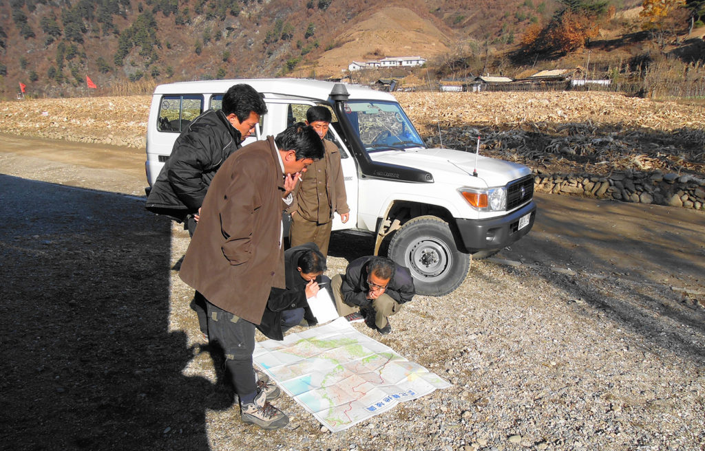

But first we had to make a check on the other set of maps we carried. Although still not highly detailed, unlike the 신산경표 지도, these topographical maps contained roads, with a good mixture of Chinese and Korean text written on it. I had bought it at the Joongang map shop in Seoul, and remember well the occasion when I walked in and asked them if they had any good maps of North Korea. They had wandered out the back and produced a set of two 1: 620,000 scale maps that had been published in 1992. When I told them why I wanted them, the staff had been both excited and weary of my ambitions in North Korea.
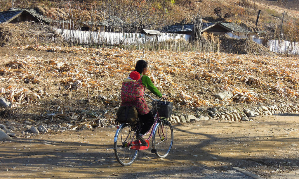
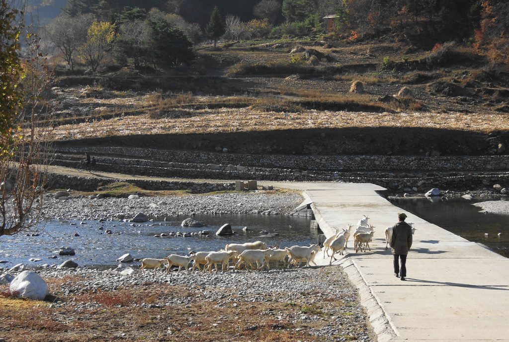
We lay the Chinese road map on the ground and did some calculations. In the silent countryside I heard the sound of an approaching squeaking spoke, and looked to see a young mother cycle past us on the bumpy road with her baby strapped to her back. I glanced around some more, and behind me saw an old farmer clutching his wooden crook as he herded his goats across a weir, that ran over a sparkling stream. On its banks a willow tree listed like a failed ballerina.
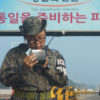
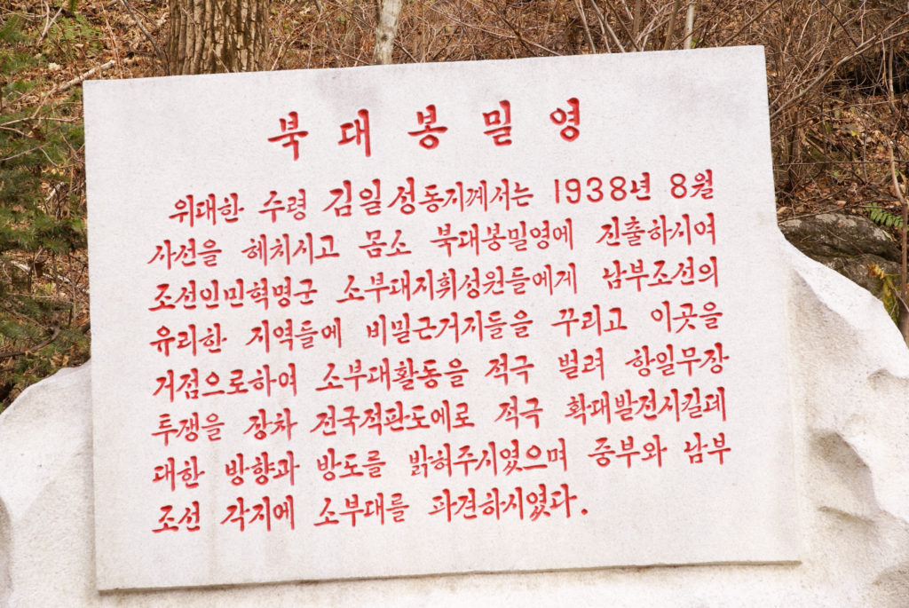
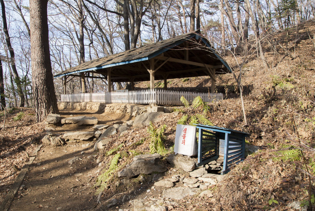
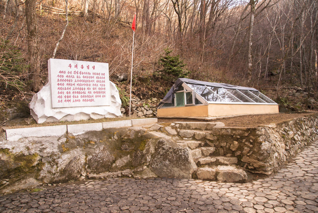
Crossing the same weir, we drove up the mountain road towards Bukdaebong, and without stopping zoomed through an open gate past a small wooden office that looked like the entrance. I wasn’t sure if that was a good idea, but we continued up the mountain in long coils for about 1 kilometer before ending at a small camp manned by a couple of young soldiers. After speaking to them we began our walk up towards the attractions of Bukdaebong on what was another fine October day. I wasn’t feeling well, and had a bit of a runny tummy. The trail was well maintained and lined with trees. A short time later we arrived at a site of historic importance. Protected by more young soldiers, the site preserves the relics of one of Kim IL Sung’s secret camps. Translated to me through Hwang Sung Chol, this is what I was told. During the illegal occupation of the Korean peninsula by the Japanese, factions of guerilla freedom fighters were spread out over the peninsula. Later to become North Korea’s first leader, Kim IL Sung inherited the cause of his father Kim Hyong Jik, who founded the Korean National Association, the biggest anti-Japanese underground revolutionary organization in the country at that time, on March 23rd 1917. He would later swing it away from a nationalist movement towards a communist movement. I know this theory is hotly debated outside North Korea, but here I was standing at one of the partisan sites, so listening to their theory was important.
우리는 한문으로 표시된 도로 지도를 땅에 펴놓고 거리를 계산했다. 조용한 시골에서 아기가 우는 소리가 들렸다. 그래서 소리가 나는 쪽을 보았더니 아기를 등에 업은 젊은 여자가 자전거를 타고 울퉁불퉁한 길을 가고 있었다. 내 뒤에서는 나무 지팡이를 움켜쥔 한 늙은 농부가 염소 떼를 따라가고 있었다. 그들이 강둑을 건너갔는데, 강둑에는 한 버드나무가 넘어진 발레리나처럼 쓸어져있었다.
우리가 탄 자동차는 같은 강둑을 넘고, 북대봉으로 가는 산길로 접어들었다. 작은 목조 사무실을 지나자 이 지역의 입구로 보이는 문이 있었다. 자동차는 이 열려있는 문을 정차하지 않고 획 통과했다. 그 뒤 꼬불꼬불한 산길을 약 1 km 올라가니까 길이 끝났는데, 그곳에 두 젊은 병사가 있는 작은 야영지가 있었다. 우리는 그들에게 말한 뒤 북대봉의 볼거리들을 향해 걸어 올라갔다. 그 산길은 가꾸어져있었으며 나무들이 숲을 이루고 있었다. 잠시 뒤 우리는 역사적으로 중요한 한 장소에 도달했다. 그 곳은 일제 강정기 때 항일 게릴라 전투를 벌인 김일성의 한 비밀 기지였다고 하는데, 여러 명의 젊은 병사들이 지키고 있었다. 이런 항일 게릴라들이 백두대간과 그 정맥들을 이용했다고 한다.
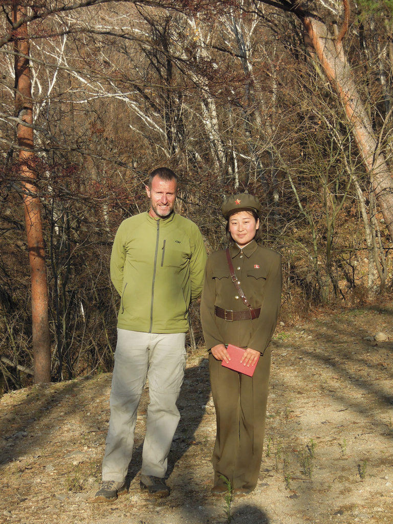
잠시 뒤 우리가 하산하기 시작했는데, 도중에 거의 달리듯이 빠른 걸음으로 산길을 올라오는 한 젊은 여군과 만났다. 그렇게 열심히 걸어서였는지 그녀의 볼이 붉게 홍조를 띄고 있었다. 우리를 보자 그녀가 미소를 지었는데, 아주 예뻤다. 그녀와 이야기를 나눈 뒤 우리가 먼저 통과한 문에 그녀가 주둔하고 있다는 것을 알게 되었다. 만약 우리가 차를 세우고 말했으면 그녀가 우리의 안내자가 되었을 것이라고 했다. 비밀 항일 기지에 관해서 이미 우리가 설명을 들었기 때문에, 우리는 계속 하산하여 자동차가 있는 곳으로 갔다. 그곳에서 그 여군은 그 지역에 관해서 추가 설명을 해주었다. 그녀가 말하고 있을 때 해가 따뜻하게 비추었다. 그녀가 입고 있는 황록색 군복은 한국전 때 중공군이 입었던 것과 같은 것이었다. 그녀의 모자에 달린 붉은 별은 공산주의를 나타내는 것인데, 그녀의 볼과 그녀의 밝은 붉은색의 노트북과 잘 어울렸다. 그녀가 노래를 부르겠다고 하여 우리가 나무에 걸터앉아 들었는데, 가사는 모르겠지만, 혁명가 같았다. 그녀는 산 계곡에서 나타난 오페라 가수 같이 노래를 멋지게 불렀던 것이다.
우리 모두는 자동차에 타고 산길을 내려갔다. 차 안의 자리가 비좁았기 때문에 여군 안내원은 거의 내 무릎에 앉은 듯이 되었다. 나는 남자 동료에 밀착되는 것보다 그녀와 붙어있는 것이 훨씬 편안하다고 말했더니, 모두 웃었다. 자동차가 사무실 문에 정차하여 그녀를 하차시켰는데, 그 뒤에도 우리들은 여전히 나의 발언 때문에 웃었다. 거기서 일단의 병사들이 모여있었는데, 연장자인 한 장교가 우리에게 다가왔다. 그가 나의 인솔자와 이야기를 나누었는데, 먼저 자동차가 정차하지 않고 문을 통과한 것을 따지는 듯했다. 우리가 차를 멈추고 우리의 신분을 밝혔어야 했던 것으로 보였다. 그러나 한참 뒤에 이야기가 잘 풀렸다. 우리는 모두 서로 악수를 나누웠다. 한편 이때 내가 그 여군 안내원에게 나와 결혼하지 않겠느냐고 물었더니, 그녀가 더욱 얼굴을 붉혔다. 우리는 다시 즐겁게 길을 떠났다.
Operations were extended mainly in the northern reaches of the peninsula, with planning and preparation done in the highland confines of Baekdu-gowon and Korea Manchuria. The camp that I was looking at was a hide-out on which members of the movement would operate from. This site was one of the most southern arms of this resistance movement. To protect its historical significance, low roofs were elevated above sites in the camp to protect remnants of tools, weapons, clothing, and other pieces of evidence from the men and women that used this place during the revolution.
One of the soldiers then went on to describe how the camps were used. He said, that Kim IL Sung had visited this camp and motivated partisans to continue with the struggle. When talking to them he would bring new plans and ideas on how to combat the Japanese, including results of other struggles throughout Korea. As I stood there and listened, I found it an intriguing part of Korean history, and one not well covered in the west. This was brought to life even more, when the soldier told us how numerous secret camps were based along the flanks of the Baekdu Daegan in what was then an undivided Korea. The Great Ridge and its 정맥 were used by the anti-Japanese freedom fighters including Kim IL Sung to transport their campaigns along, navigating in and out of Korea from Manchuria to do so. Most of this activity I assumed existed in the northern half of the yet to be split peninsula, because of its remoteness and close proximity to mainland China’ and its own dire Civil War as well as a haranguing Japanese presence. The mountains of Korea being home for their people since time forgotten, were like the veins they could feel in their bodies, they knew where every ridge went, and like blood, they gushed along the ridges in an attempt to wrench independence from Japan.
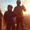
Shortly into our descent down, we ran into a young North Korean female soldier who was puffing up the trail at almost a run. The exercise had left her with crimson flushing cheeks. On seeing us she smiled and lit up the forest, she was very pretty. On talking with her we had discovered that the gate we had driven through earlier was where she was based, and that she was to be our guide if we had stopped. As we had already been briefed at the secret camp, we continued our walk down the mountain back to where the vehicle was parked. Once there the female soldier gave us some more information about the area. As she spoke the sun shone warmly. The olive uniform she was wearing was the same one that the Chinese wore during the Korean War. The red star of communism on her cap shone bright like her cheeks and matched her bright red notebook…and then she said she wanted to sing a song. Excited we sat down on a log and let her begin. I was unsure of the words but it was definitely a freedom fighting song, and she looked like an angelic mountain singer as she stood singing through the valleys of Korea.
We all squeezed into the Toyota and weaved our way back down the mountain road. Our female guide was almost sitting on my lap due to the lack of space, which caused me to say that it was much more comfortable being snuggled up to her than my male colleagues, which fortunately everyone saw the funny side of. We were still laughing when we got to the office gate where we had to stop and let her out. A small posse of soldiers had accumulated there, and the eldest, an officer approached us. While he was talking to my hosts, I stepped to one side and had a cigarette. It appeared that instead of racing through the gate as we had done earlier, we should’ve stopped and introduced ourselves. I wasn’t sure if this was serious or not, but there was a slight hint of humor about our naughtiness, and it seemed that the officer knew this as well. Because we had come down the mountain in such high spirits, this feeling had managed to override any of the seriousness of our error. In the end it all worked out fine. We all shook hands with each other, I asked the female guide if she would marry me, of which she quickly said ‘No!’ and we all went on our merry way.


In reflection hearing the other side to the story of Korea’s recent history straight is always refreshing. I can’t always be too sure who’s right and who’s wrong, but having access to both sides of the story is at least a start, something which neither the North or South currently allow. I also knew that history from most regions of the world, including the American led west could not be accurately trusted either, and many lies had been planted in our minds by them and my own governments too, so who really was to say that this part of Korean history in the northern part of the peninsula that I was standing in now, wasn’t entirely accurate in places either. It would certainly suit the South Korean leadership, the Americans and their allies to suggest otherwise, as they do. In the end, I have experience in government, law enforcement, soldiering, and life, and these days I preferred to keep an open mind about history. In a way what history we were all forced to learn at school, and most of mine was WWI and II history, is a form of brainwashing or human cultivation too, not all bad, but sometimes inaccurate and unreliable, and history as we know is written by its conquerors, who become our governments. If you want to know something otherwise about history, then you have to find that out yourself, as I was now. So, I was always willing to listen to new stories and new theories about that delicate part of Korean history, especially as there is not much written in English about the communist movement in that part of Korea during that period.
Traveling Korea’s mountains is as much about the social experiences and friendships you make as much as it is the undulating beauty that comes with it. For me it has also been about learning; and Korea’s jagged mountains have always provided me with stories of her past, it was like a giant outdoor museum, especially in the South. Mountain was my school. Now I was here in the North, I was able to add more. Along with that, I felt I was also forming friendships here, be it with my hosts, county guides, local farmers, or the soldiers we sometimes met, it didn’t seem to matter. Maybe for me it was because the mountains of Korea were all connected with each other, they were all part of the same mountain family, and even though politically different from the South, the people here didn’t seem indifferent, they were still part of the same family. It still felt very strongly like Korea here.
원래의 목적인 백산을 향해 우리 자동차가 조용한 시골을 달리고 있을 때 나는 그 예쁜 여군을 생각하면서 미소를 지었다. 나는 북한에 와서 호텔이나 마을에서 이곳 여자들과 재미있게 이야기를 나눈 적이 있었다. 나는 인솔자인 황에게 내가 북한 여자들에게 집적거려도 괜찮으냐고 물었다. 그가 차에 탄 다른 사람들에게 그 질문을 농담조로 통역하자, 사람들이 웃음을 터뜨리면서 괜찮다고 했다. 황은 그것이 재미있을 것이며 걱정할 것이 없다고 그들이 말했다고 나에게 전했다. 이유는 여자들도 기분 좋아할 것이기 때문이라는 것이다. “나는 늘 성적 매력보다 전통적인 한국적 모습 때문에 북한 여성들에 매력을 느껴요.” 하고 내가 덧붙였다. 황이 이 말도 통역하자 또 한바탕 웃음이 터졌다. 황이 “당신이 남조선의 김삿갓인줄 아는데, 여기서도 그래도 괜찮아요.” 하고 말하자 다른 사람들이 더욱 크게 웃었다. 산들을 돌아다니다 보면, 펼쳐지는 아름다운 경치도 구경하지만, 또한 사람과도 만나게 되고 우정도 쌓게 마련이다. 아마도 나는 이곳에서 그들과 산행을 하면서 농부든 군인이든 산의 사람들과 만나면서 새로운 우정을 맺고 있는지 모르겠다. 강산의 중립성이 우리 모두를 단순하게 만들고 있다.
이날 새롭게 발견한 것들을 앞으로 어떻게 소화할 것인가에 관해서 생각하기 시작했다. 나는 미래의 나의 책을 위해 한국인들이 역사를 통해 갖고 있는 차이를 극복하고 사실적이면서 용납되는 내용을 제시하지 않으면 안된다고 생각했다. 나는 남북한의 차이를 모든 사람을 존중하는 어떤 형태의 공통점으로 승화시킬 수 있기를 희망하고 있다. 백두대간의 인지가 그것을 도울 수 있다고 나는 믿는다.
Published in 2016 as part of a Daum crowdfunding series.